Global Bird Collision Mapper — How to Report Bird-Building Collisions
FAQs on Getting Started with the Global Bird Collision Mapper
What is the Global Bird Collision Mapper?
1
The Global Bird Collision Mapper (GBCM) is an online geo-mapping tool designed for registered users to report the locations of bird-building collisions across the globe. One can enter these records from their laptop, tablet or mobile device. The details of each report can be seen by anyone who visits GBCM.
Your bird collision records will not only help demonstrate the magnitude of the problem, but they will help inspire further development of effective preventative measures and standards designed to protect bird species.
How do I enter a bird-building collision into the Mapper?
2
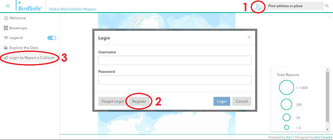
To enter a collision record, you need to start by creating an account. To the right of the Mapper header, there is an account icon that will pull up the login window. At the bottom of the login window is the register option. Once you have entered your account information, you will need to verify your email address. Once you are logged on to your BirdSafe® Mapper account, you can enter a collision report under the menu icon.
When registering as a GBCM user, it can take up to 20 minutes to receive a verification code. Be sure to check your junk mail if the verification code doesn’t arrive.
How do I join a group?
3
You can request to be part of a group by emailing mapper@flap.org and providing your account name and the name of the group you are trying to join. We will add you to that group and you will then be able to add entries with that group.
Once you have an account, you can be part of multiple groups.
To create a group in the Bird Collision Mapper, simply fill out the group request form at the bottom of Flap Canada’s Global Bird Rescue Manual and email it to mapper@flap.org. We will create the group and add members for you. Once individuals are registered as part of a group, they can submit reports independently or as a group entry. Make sure to indicate you want to create a group in the subject line of your email.
FAQs on Reporting Bird-Building Collisions in the Global Bird Collision Mapper
Why can’t I locate the building on the map where I found the bird?
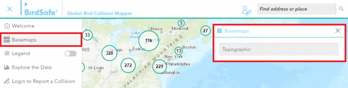
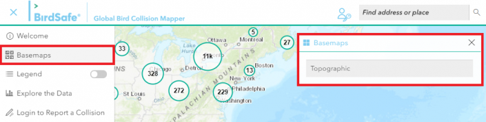
Explore different basemaps when you can’t locate a building on the default topographic map. The satellite map tends to be the most up-to-date map. The option for basemaps can be found in the navigation dropdown.
Do I need to identify a bird species in my Mapper report?
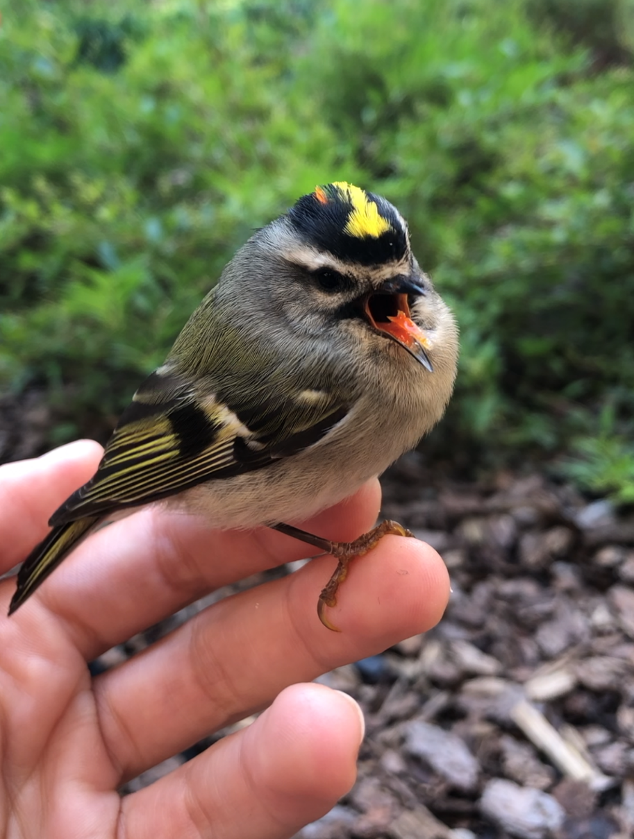
You are not required to identify individual bird species to report collisions. In fact, we discourage entering a species name unless you are skilled at bird identification. We do however encourage including a photo of the bird for the purpose of possible identification at a later time.
If you wish to familiarize yourself with bird species to aid with identification, there are several excellent bird identification guides available for purchase at your local bookstore. The Peterson Field Guide to the Birds of North America and National Geographic Field Guide to the Birds of North America are both good guides. In addition, the Cornell Lab of Ornithology has a phone app called Merlin Bird ID, which is able to identify the possible species of a bird with a photo.
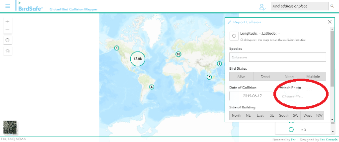
Why can’t I locate the building on the map where I found the bird?
Explore different basemaps when you can’t locate a building on the default topographic map. The satellite map tends to be the most up-to-date map. The option for basemaps can be found in the navigation dropdown.
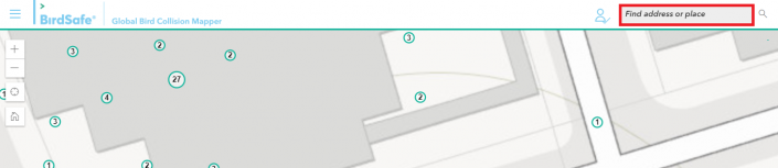
You will find that pressing the ‘Find my location’ icon isn’t always accurate. To ensure you are entering a collision record at the correct location, consider entering the building address into the ‘Find address or place’ field located in the GBCM header.
Why are my collision entries not showing in the correct location?
To ensure the accuracy of a collision location, locate the building on the map where you found the bird. This can be done in one of two methods:
enter the address of the building into the Find address or place box in the upper right-hand corner of your screen.
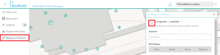
OR click the Use my location icon at the top left-hand corner of the Report Collision form. Click this icon 2 or 3 times to assure accuracy.
You will find that pressing the ‘Find my location’ icon isn’t always accurate. To ensure you are entering a collision record at the correct location, consider entering the building address into the ‘Find address or place’ field located in the GBCM header.
For your last step: Once you have located the building on the map, identify the side of the building where the bird was found and zoom in to a closer magnification before clicking on the map to enter you record.
How do I access my reports?
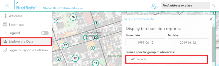
To access your collision reports, you can either locate your report on the map, or search for your entries under the “Explore the Data” under the menu icon. Enter your username into the “From a specific observer” bar. Once you have pressed enter, your reports will show up on the map and you can either click on them individually or scroll through them in the total reports.
How do I edit or delete a report?
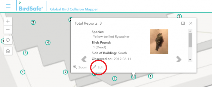
Currently, you can only edit one of your entries within 7 days of creating it. Once you have found the specific report you want to edit on the map, you can select the report and click the small edit button in the bottom left corner. If you accidentally made an entry and want it deleted, simply email mapper@flap.org with the details of the specific report and we will delete the record for you.